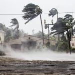
As of early Friday, Hurricane Ian has continued to grow in strength, with forecasters expecting it to make landfall along the Carolina coast later in the day. Ian strengthened back to a Category 1 hurricane overnight as it moved west over the Atlantic toward the U.S. eastern coast, after making landfall in Florida as a major Category 4 storm on Wednesday with 150 mph winds. Hurricane Ian has left a wake of death and destruction throughout Florida, and forecasters now warn the storm will bring “life-threatening storm surge and hurricane conditions” to the Carolina coast.
In its 5 a.m. EDT update, the National Hurricane Center said that the center of the storm was located 145 miles south-southeast of Charleston, S.C., and 225 miles south-southwest of Cape Fear, N.C., traveling north-northeast at 9 mph. Forecasters expect that it will reach the coast of South Carolina on Friday before moving farther inland across the Carolinas into Saturday. The storm grew in strength overnight, and had sustained winds of 85 mph hour as of 5 a.m. Forecasters predict there will be little change before it makes landfall, after which it will undergo rapid weakening.
A turn toward the north is expected Friday morning followed by a turn to the north-northwest with an increase in speed Friday night. The National Hurricane Center said: “On the forecast track, Ian will approach the coast of South Carolina on Friday. Ian is forecast to become an extratropical low over North Carolina tonight or on Saturday. The low is then expected to dissipate by Saturday night.”
The NHC said in its update:“The combination of storm surge and the tide will cause normally dry areas near the coast to be flooded by rising waters moving inland from the shoreline Water could reach up to 7 feet in some of the areas under a storm surge watch.” A hurricane warning has been issued for the North Carolina coast; and a storm surge watch is also in effect for north of Cape Fear to Duck, N.C., and for the Pamlico River and the Cape Fear River while a hurricane watch was issued from east of Cape Fear to Surf City, N.C. A hurricane watch also remains in place for east of Cape Fear to Surf City; and a tropical storm warning remains in place from the Flager/Volusia County Line to Savannah, Ga.; Cape fear to Duck, N.C.; and Pamlico Sound.
Editorial credit: FotoKina / Shutterstock.com
